cahexgrids
The goal of cahexgrids is to provides a hierarchical geospatial hexagonal grid indexing system for Central America
Hexagonal grid resolution are 4, 5, 6, 7 y 8 (based in H3
Installation
You can install the development version of cahexgrids from GitHub with:
# install.packages("devtools")
devtools::install_github("ManuelSpinola/cahexgrids")
Example
This is a basic example which shows you how to use cahexgrids:
ggplot(ca_hex_grid_res_4) +
  geom_sf(fill = "dodgerblue3", color = "gray") +
  theme_minimal()
Figure 1. Hexagonal grid of resolution 4 for Central America.
ggplot(ca_hex_grid_res_5) +
  geom_sf(fill = "dodgerblue3", color = "gray") +
  theme_minimal()
Figure 2. Hexagonal grid of resolution 5 for Central America.
ggplot(ca_hex_grid_res_6) +
  geom_sf(fill = "dodgerblue3", color = "gray") +
  theme_minimal()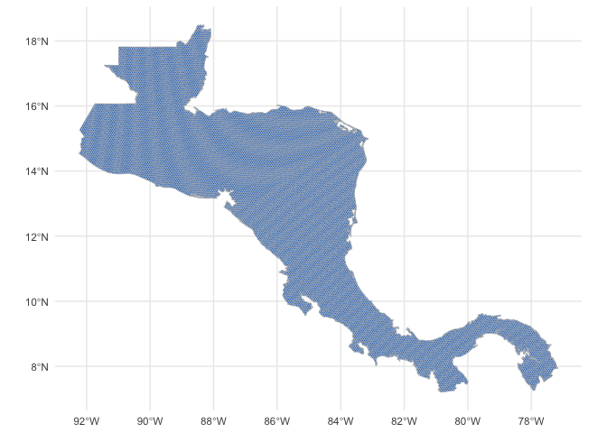
Figure 3. Hexagonal grid of resolution 6 for Central America.
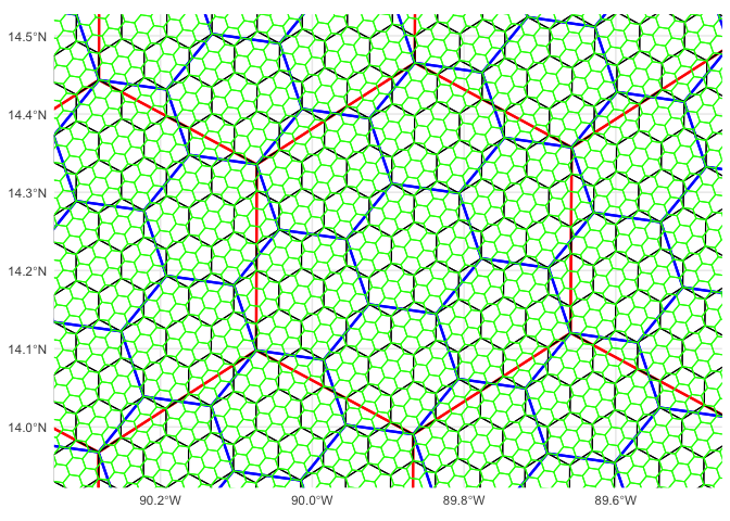
Figure 4. Hierarchical hexagonal grids of resolution 5, 6, 7, 8. Every hexagonal cell has seven child cells below it in this hierarchy.